State of Maps
November 30th, 2025 | by Andreas Richter
(8 min read)
Humankind is mapping the world since the very beginning. Paper maps helped us to navigate, later-on digital maps helped systems to navigate us. The global view was further detailed to a lane level to navigate through complex multi-lane scenarios. Finally systems started to support and take over driving tasks such as lane keeping or lane changing which need also an understanding of the environment on lane-level.
Digital road representations are generated by map makers since decades, and since some years more and more details get introduced by exploiting new data sources with the help of new tools.
Traditional Map Making
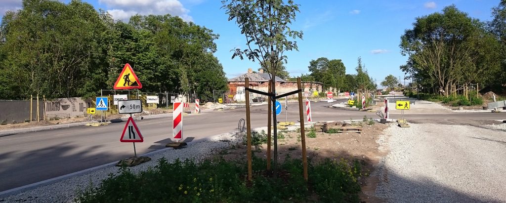
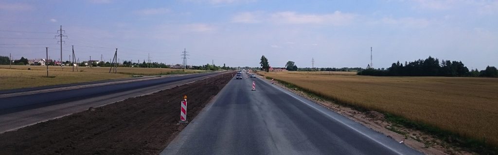
In general, map providers operate fleets of vehicles to collect data to build and update their maps. From vehicle perspective you see the relevant data you need for automotive applications. Scenes are observed multiple times from different perspectives and therefore can deliver a 360 degree picture. Frequently delivered vehicle data can provide updates about changes at short notice.
Additionally, aerial images are processed by map makers to derive the basis as bigger picture with reliable accuracy and repeatability. It is easier to patch an existing map of similar quality instead of compiling a new map based on heterogeneous data. Aerial images provide a large areal coverage representing the same conditions whereas probe data is recorded with different sensor calibration quality during various environmental conditions.
The scope is always to provide data about major roads first, down to minor roads. The most relevant traffic is operating on major roads and, therefore, most probe data is collected there. For navigation, standard definition (SD) maps are applicable and can easily be derived from aerial images. Accuracy does not have to be high. The first advanced driver assistance systems (ADAS) were implemented for highway use cases (limited complexity, good quality of infrastructure) and, therefore, high definition (HD) maps representing also lane level were introduced for major roads first. The demand for ADAS support required additional information that can enrich the map. Purpose-built data layers can improve safety and efficiency, e.g. by providing elevation profiles for optimized energy consumption, driveable paths provide efficient and safe routing, road conditions can warn about hazardous spots. These layers are provided as added-value service so that the base map isn’t impacted and does not have to be updated frequently. HERE ist providing such kind of added data layers under the umbrella of their so-called UniMap. Such additional data can be used to compile information for other stakeholders such as road operators or insurance companies providing e.g., an indication about the suitability of the roads for automated driving.
Advanced Map Making
There are also specialized map providers in the game. They have only vision systems but specially equipped vehicles to conduct highly accurate measurements. Sometimes multiple scans are necessary to cover every spot especially on multi-lane roads or in dense traffic situations. What they deliver is a precise recreation of the real world as one snapshot that can serve as ground truth for e.g., simulation where frequent updates are not necessary because they don’t need to be up-to-date. If so, patches are often incorporated manually.
Need for Maps
The next big thing are automated and autonomous driving systems (ADS) which could utilize more data. A map supports the system by providing knowledge about the surrounding. The navigation use case is easy to understand, because nobody can tell from the starting point Berlin how to navigate to Munich. For keeping systems in lane and let them adapt to speed limits the sensor range gets crucial. Like the viewing range of humans also the sensor range is limited and may be additionally impacted by scenery or environmental conditions (such as curves and hills as well as darkness or particulates in the air). Humans may compensate this by having a mental model, which tells them how the road will likely continue. Additionally a lot of them know the streets by heart due to multiple rides. Systems, which are not storing a map are doomed to always encounter undiscovered land. All unusual situations have to be managed right after perceiving them and the systems may always take the wrong decision. Why not keeping the knowledge about the environment that is only changing slowly and therefore this knowledge does not need frequent updates? For sure, having this knowledge and discovering differences between it and reality creates new challenges but sensor fusion has to deal with this assessment anyway. At the end the map is serving as another sensor input.
Wheres SAE level 3 system usually continue the path of ADAS – this means operating in major roads and trying to apply it to the next lower levels of roads category – SAE level 4 systems are often planned to get operated in urban areas and if most of the transport and mobility demand shall get addressed, also minor roads have to be covered (for sure the application starts with operation on more major roads but not addressing motorways for safety reasons).
New Kids on the Block
The self-driving system (SDS) developers often build purpose-driven maps to enable SAE level 4 systems in urban environments. The HD map is reduced to the minimum viable amount of information to reduce map data maintenance effort. In contrast, these maps often get extended by information to support decision making of the SDS to cover situations that may occur locally and are too expensive to fix in general in the code.
It is easier to follow a driveable path that is created by the fusion of various human drivers and, if necessary, deviate from it a little bit to avoid obstacles compared to computing the potential driveable area and determine a suitable course. Nevertheless, it is the question whether the SDS learns from the best if e.g., the human drivers always cut inside turns or do not stick to the speed limits. Also temporal dependencies such as different road conditions with parked cars causing dense traffic situations or temporary restrictions could deteriorate the guidance. For that an additional data layer about regulatory information can help so that speed limits, lane change possibilities or turning information won’t be deterred from faded road signs and markings. Nevertheless reality is knocking, and if there is a new line or sign at the road and not represented in the map, reality rules.
Also behavior triggers for specific locations can be incorporated to trigger, for example, lane change in advanced to not let the defensive system run into situation that can be a challenge. At the end, all of these extensions have to be maintained as well and often manually added to the map. Besides road regulation there is no data source that can provide this information for automated incorporation. It has to be checked manually and is, therefore, a drawback for scaling.
But automated driving under specific conditions can also happen off public roads e.g., on private properties such as harbors, factories or mines. The latter represent also applications where HD maps may not help at all because specific roads (and their lanes) are not fix and may not be as obvious as usual. In this case pure perception has to solve the task without additional knowledge. Dealing with low speed applications and limited areas it is a suitable way.
Improving Map Creation and Update
It is obvious to use AI methods to improve the process of creating and updating maps. Vision Language Models can help interpret input to provide data. Aerial images are a good use case because it is easy to create proper training data since most of the data processed later on is created having the same view (from above) at the same time. This minimizes heterogenous images but for sure, seasonal changes will have an impact anyway. Nevertheless, a data set recorded at the same time covers a huge area such as metropolitan areas with the same properties. Thus, the content is easily processable for pattern recognition because the data contains only few “unexpected” scenes (and it would be easy to add them as training data afterwards). Extracting objects is one use case, measuring values such as width of lanes is another one that is enabled by absolutely accurate input material representing just the two dimensions (X and Y) we are interested in. HERE is using for their UniMap also a lot AI-driven algorithm to collect and process data.
But AI can do more. With the help of content creation patterns gaps in the map can be closed by Language Models based on likelihoods or missing data added. This is an extension of just pattern recognition and recreation algorithms. At the end completely new maps can be generated but this is a different story. If there is no trust in that generation – catchword hallucinations – then models can at least point to the problematic locations and generate potential solutions which get selected by experts.
Another use case for AI is data transformation. Converting them from one format to another is self-explaining but extracting only the relevant data for a specific use case is the more interesting one. With this purpose-built maps can get generated without losing all additional data in the background that is used for different reasons (e.g., quality assurance but also utilizing it for different use cases).
Best of Both Worlds
The layout of roads and the road-side infrastructure is not changing very frequently. The dimensions and locations are still a valuable input for ADAS and ADS (e.g., for localization purpose). This basic information can be provided by established methods in a high quality (see Traditional Map Making). Change detection and data about missing and/or new elements can be provided by analyzing vehicle fleet data (see Improving Map Creation and Update) and all of that will be fused in one map.
The last challenge is to talk about the same. The foundational data such as the road layout and infrastructure should be represented using unique global identifiers. The Global Entity Reference System (GERS) of Overture Maps is providing such kind of identification method. It is designed to be utilized by various stakeholders building their use cases on top of this base layer to enable their own services. Data become interchangeable because of the global uniqueness, location referencing between different data sources is not necessary any more. This makes sense especially because all the systems are driving on the same road in reality. Why not have the same digital representation? It is not really a competitive advantage to have the best representation of the real world, it would be just double work multiple times with the potential of ambiguities. The unique selling point can be built upon the basic map, transformation of the basic map will continue to cause data loss.