Stakeholders of Mobility
March 30th, 2021 | by Andreas Richter
(8 min read)
It is safe to assume that traffic will be automated and connected by enhancing the current assistant systems to automated driving systems. But not only the classical road traffic will be automated, also light rail systems and robot fleets for commercial ground-based as well as airborne last mile transport will make this transition. Before automated driving functions will hit the market, they have to be tested in various situations and scenarios derived from the real world and later on in the real world as well. But a new major challenge is that many diverse stakeholders have an interest in using the traffic area. This interest is not limited to transport solutions; new stakeholders appear, which would like to distribute and sell mobility services, information about e.g. events, locations and the traffic itself, also using gamification methods. In the meantime other stakeholders are monitoring, operating and managing the traffic area, and others, again, plan the further development. Thus, the traffic area appears to be the sticking point when organizing further mobility.
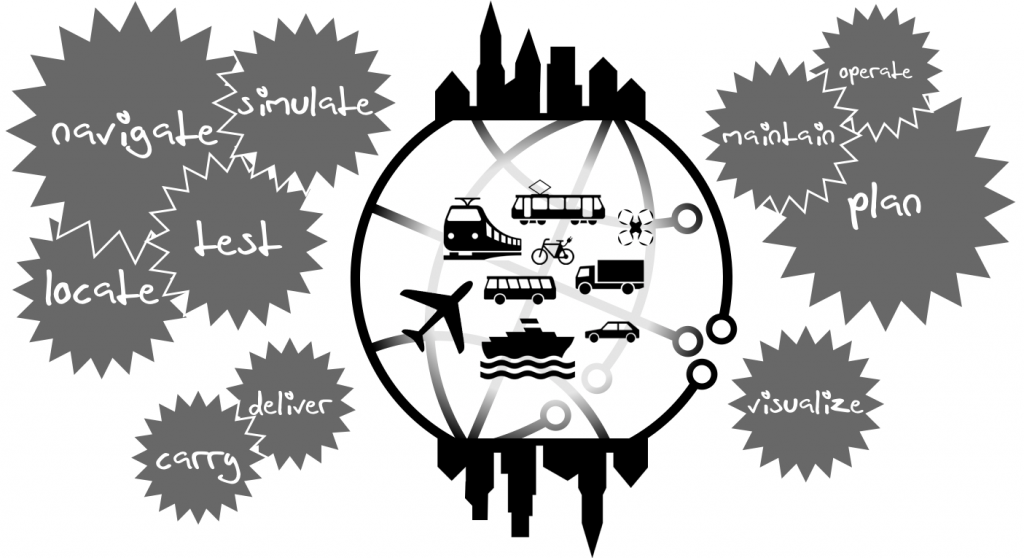
So, who else could have a stake in mobility? Let’s talk about one of the five pillars of our project: stakeholders of mobility and their mission. We will cover the following ones:
- Vehicle Manufactures
- Infrastructure Operators
- Governmental Bodies
- Fleet Operators
- Citizen
Vehicle Manufacturers
The first stakeholder are the vehicle manufacturers (OEMs). Their main motivation is to sell vehicles with specific functionality for specific purposes. In recent years more and more (advanced) driver assist systems (ADAS) entered the market such as navigation, lane keeping, distance control or (automated) park assistants. The goal is to enable partially automated driving (SAE Levels 3 and 4, see Wikipedia) or even fully automated driving (Level 5). To achieve this a lot of sensors and computing infrastructure are implemented in the vehicles which increases the complexity. Everything has to be tested and proven to be fail-safe and withstand harsh conditions. What has been done in field trials only in former times has to be complemented or even replaced by simulation because otherwise you would have to spend so much time to test for each situation your application should master, that a vehicle would easily be outdated before being able to go on sale. Performing a simulation requires a lot of information in order to create a useful digital twin of both, the system-under-test and its environment (read more about this in our feature “Geodata in Simulation“).
The navigation system needs geodata input, too, and, how often did we read in the news that somebody sunk his car because a ferry connection or harbor was not mapped properly? Considering an increased map resolution and thinking about micro routing (e.g., complex intersections or car parks), how often did we read that somebody ended up with his car on streetcar tracks or in a subway entrance? The world is constantly changing and therefore maps have to be updated continuously. The OEMs seem not to be doing this by themselves but, instead, to be receiving the data from mapping companies (read more about map data in an upcoming feature about map data and formats). For that mapping companies have to operate, among other mobility stakeholders, huge mapping vehicles fleets to keep at least the main road network up-to-date.
Information technology (IT) companies are interested in automated driving because it is a heavily data-driven business segment and IT knows best how to handle data (and how to build business cases upon that). Their advantage is that they can start almost from the scratch, dealing only with data and developing proper software. Once they have a working automated driving application (autonomous stack) ready they can put it into some kind of hardware and pursue their business – the vehicle merely serves as a “platform”. We have already seen this in the smartphone domain and we will see it in the vehicle domain as well. The OEMs start from the other side: they develop the hardware and and try to add functionality while still incorporating all their legacy systems.
What we should not forget are the rail vehicle manufactures (OEMs as well). The market is structured in a different way – vehicles are bought and operated by governmental bodies and fleet operators – but in the end it is the same case as for road vehicle manufactures: more and more assistance systems are introduced with the goal to have automated driving also in heterogeneous rail networks. The vehicles are collecting more and more data about e.g., occupancy, energy consumption and wear. These data are analyzed with machine learning algorithms to optimize service times and utilization.
Summary: vehicle manufactures need a precise digital twin of reality for development, test and validation of new vehicles as well as precise data for supporting the functionality.
Infrastructure Operators
If there is infrastructure, somebody should take care of it and if there is currently no infrastructure, somebody will build it. Often this task is done by governmental bodies but in “modern” societies public-private-partnerships (PPP) are founded or the task is assigned to a 3rd party completely.
The main goal of the road and rail infrastructure operators is, as their name suggests, to “operate the infrastructure”. That includes to know everything about their assets: what is installed where and in which condition is it? Additionally, it is necessary to know all about the current usage: is the traffic or energy flowing or is there any congestion?
The next level will be to use the data for planning: knowing the infrastructure, its capacity and the traffic demand, can different routes, parking spaces or transport modes be used by traffic participants in peak times? What happens if a lane has to be closed down or can the traffic light program be optimized? Are there any alternatives for special purpose traffic (e.g., routes or time-of-day)? These types of information have to be distributed to the road participants as traffic reports and route recommendations but can also be monetized, such as information about available parking spots.
It is necessary for infrastructure operators to be prepared in advance because mobility and transport is an essential part of modern society and economy. If mobility collapses, it has a great impact on other parts of life, such as critical supply chains. Therefore, in order to cope with coming challenges and future questions, the operators should be able to rely on a properly working data lake and not just on analogous offline data.
Also, the long-term perspective is important: if new roads or neighborhoods, industrial areas or even complete cities are planned, this cannot be done using the state-of-the-art methods; we have to take into account that technology, mobility, demand and purpose are changing and that infrastructure should be beneficial and versatile (cue Smart City). Therefore, infrastructure operators have to know in advance how the world might be changing.
Last but not least, let’s not forget about private areas such as harbors, airports, large factories, agriculture or mines. These special-purpose areas contain a lot of specialized traffic often combined with an additional need of safety and security.
Summary: infrastructure operators are hosting digital twins of the world to know the status of their environments. They should be utilized to support planning of, e.g. traffic in simulations and visualizations. In a long-term perspective the planning data should be utilized in the same way e.g. for decision making.
Governmental Bodies
Public authorities play an important role not only because of their legislative power but also because they are often the stakeholder to build and operate traffic infrastructure as well as public transport and vehicle fleets (see previous and next paragraph).
On top they have to take care of urban parks, housing, energy supply and waste disposal. For that a lot of cadastral data have to be managed and maintained. These data are also the basis for further procedures, e.g. monitoring and calculating noise emissions and air pollution (and their possible dispersion) as well as planning alternatives and their visualization for decision makers and 3rd parties. As you can imagine some of these topics have an impact on traffic and mobility or vice versa.
Summary: in addition to the data of infrastructure operators, governmental bodies are hosting data about the environment that can interact with or impact mobility. It should be utilizable for planning as well.
Fleet Operators
We might think about rental cars and taxi services if we think about fleet operators. It is a good starting point but there is more: we saw electric scooters and rental bikes flooding big cities. We saw ride sharing companies approaching urban areas, delivery services (already with robot vehicles) and logistics companies populating residential neighborhoods. Vehicle manufactures are also starting mobility-as-a-service businesses to canvass new customers for their brands.
But also governmental bodies and infrastructure operators are fleet operators e.g. for public transport with busses, ferries, ropeways, light rail vehicles and train sets (and, maybe later on airborne vehicles as well); and don’t forget the police, fire department and rescue service. Also municipality vehicles for road maintenance, supply and waste disposal form vehicle fleets. All these fleets have to be managed (regarding their condition and status) and operated (regarding their current location and best-suited operational area) based on data of the vehicle, the traffic and infrastructure condition.
Additionally, private fleet operators are eager to optimize their business using data to forecast congestion, the number of customers and their demand, optimizing routes and most promising parking spaces for new customers. On the one hand, this creates a need for data that are often already generated by other stakeholders such as information about traffic demand or the infrastructure in general. On the other hand, some of the data are a competitive advantage and therefore not shared with other stakeholders (e.g., fleet distribution).
Summary: static and dynamic knowledge about the traffic network is required to keep the business running. The vehicle fleet can deliver data for the dynamic part but often these data have to be acquired from infrastructure operators.
Citizens
Yes, we are mobility stakeholders, too! We want to know when roads and public transport are overcrowded, when the next connection starts and where it stops. Wouldn’t we also like to know where the next garbage container for special waste is located or maybe also were to pick fruits belonging to nobody?
If it comes to urban planning, citizens want to be involved in the decision making process. Therefore it is necessary, for example, to generate visualizations of variants of a project and to create simulations of the variants’ impact on traffic, noise, shadowing, airflow etc. All these data should be presented and made available to the target group – if possible as open data so that everybody can work with them and verify the results. In that way decision making is heavily supported and acceptance is guaranteed.
Conclusion
There are more stakeholders involved in mobility than you might think initially. But most of them are working on the very same traffic area and trying to map the same world. It sounds reasonable to join forces, doesn’t it? A common data lake could be the answer (read more about this in an upcoming feature).
And if you want to read more about stakeholders and changing mobility without waiting for upcoming features, then have a look into this journal article: “Towards an integrated urban development considering novel intelligent transportation systems“. Nevertheless, stay tuned on GEONATIVES.org!
Thanks for this great, comprehensive and inspiring article. I hope to see you as a steakholder in summer / bbq.