Educating Settlements
July 30th, 2023 | by Andreas Richter
(8 min read)
End of 2014 started the hype of making cities smart. Before autonomous driving got popular and after the mobile phones got smart there was the idea to advance the infrastructure of our cities to support mobility and living. But what makes a city smart?
Smartphone, for example, means that the phone gets more functionality than it had in the beginning (calling, messaging and, maybe, calendar and contacts management). Most of the functionality was driven by having access to the Internet and a wider screen to display more information (and having a more convenient user interface for input, starting with keyboards and stylus-operated touch screens). But some of the new functions were enabled by additional inputs such as camera, localization and positioning sensors as well as sensors to measure human body related values (smart watches are a good example for that). Often these sensors are connected via different additional communication protocols such as Bluetooth, Near Field Communication (NFC) and proprietary but open access multicast wireless sensor network technology ANT+.
Getting Equipped
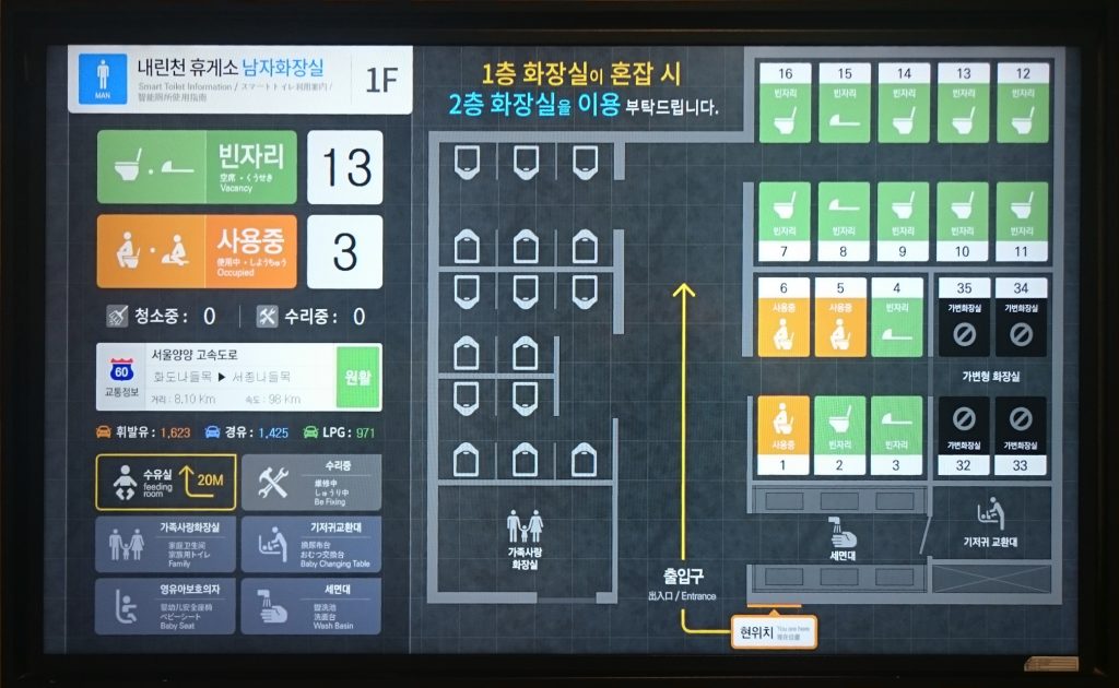
We can apply the same approach to cities as well. People already called their cities smart after installing WLAN access points or digital signpost in public buildings and areas. This might help foreigners without roaming access to cellular networks or people with low mobile data volume but not the city itself. With the help of login data you could derive first information about the people walking around, but that’s it.
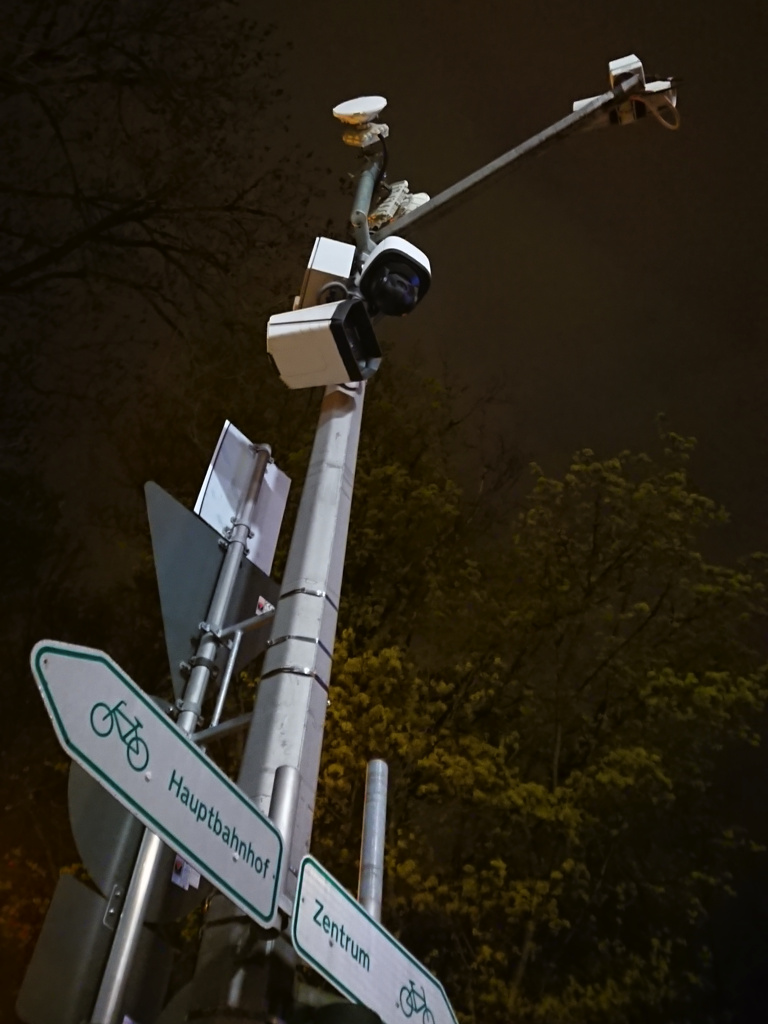
The next step was the installation of laser scanner-based measuring points for non-motorized traffic participants. It gives a better understanding of the volume and frequency of pedestrians and bicycle riders at specific locations in the city. For motorized traffic it is common practice to control the density of traffic and manage lanes; induction loops are used as well as traffic cameras. Cameras are applied for non-motorized traffic, too, nowadays often equipped with face recognition (in the name of crime prevention). Additionally, also the stationary traffic could get measured by installing sensors to check the occupation of parking lots and provide this information to roaming vehicles.
Furthermore, the environment gets measured by installing sensors with different purposes such as checking air quality, the weather in general and the condition of public areas such as ground moisture in green spaces.
With all of this information you can start to build a digital twin of your city. Such a digital representation of parts of the city can help to support urban planning and also to understand current challenges in the city. We have summarized the advantages of a digital twin in a previous feature.
To make the data available for internal consumers (within municipalities and contractors) and external ones (citizens and researchers) the usage of web portals is the first choice. Often the collected data get enriched with location information to present them as geodata. But is this enough?
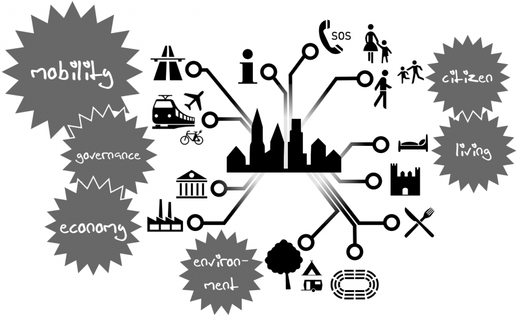
In general the term Smart City focuses on multiple domains such as economy, citizen, governance, mobility, environment and living. This includes way more than just collecting some data of traffic participants strolling around. One of the mega-trends is to transform official processes from analog to digital to create and provide self-services for citizen in all social domains and support participation especially for integrated urban planning. The International Institute for Management Development started in 2019 a Smart City Index to assess the economic and technological aspects of smart cities on the one hand, and their society aspects on the other. There you can find a short list about the smartest cities in 2023.
A key element for participation is to provide the previously mentioned data as Open Data. In the US, spending taxpayer’s money means making the result available for the taxpayers. Germany is funding Smart City projects since 2019 and provides 820 million EUR in 2023 for 73 different pilot projects. These pilot projects often focus only on one of the aspects mentioned above and often lack providing the data and the processes to the taxpayers. India started in 2014 also the funding of 100 Smart Cities but they built their own solutions, often similar but not interoperable with the solutions of the other pilot cities. Since 2019 open source tools are a must for Smart City projects (e.g., for modeling data).
Data Platforms
One of Germany’s smartest cities in the context of data provisioning might be Hamburg (which receives no external funding) with its comprehensive geodata portal called Urban Data Platform Hamburg. The data is often provided using Web Map or Web Feature Services (WMS or WFS) so that the data can be integrated into custom applications or geographic information systems (GIS). Of course, the data are visualized on Hamburg’s geodata portal. A lot of common information can be found there: Current and historical classification of area usage, a lot of points of interest from various domains with linkage to further information etc. But also other interesting data can be found at the portal such as information about intersections with equipped vehicle-to-infrastructure communication (V2I) being able to send the Signal Phase and Timing (SPaT) message so that the vehicles can adapt their driving behavior according to the traffic lights if they are able to read these messages. Also the traffic light phase for all traffic modes of a lot of intersections can be monitored live online. This is quite interesting because the current state could be consumed in real-time using a REST interface and MQTT broker just via the Internet and without special purpose communication technology such as the vehicle-to-everything communication (V2X). This would reduce the infrastructure cost tremendously because no additional hardware infrastructure (often IEEE 802.11p WLAN is used) is needed at every intersection as well as at the client side.
Data Collection
Let’s focus on collecting and providing data. Often Smart City is equated with the city as Internet of Things (IoT) and Services. Various and numerous sensors are collecting various and numerous data. Installing new fixed sensors might be a no-brainer, but it requires on the one hand high investments to cover all relevant areas and causes on the other hand a lot of running costs for maintenance. It would be smarter to let the sensors float around. Collecting data from traffic with the help of the municipal vehicle fleet such as public transport or garbage disposal could be promising. If these vehicles were equipped with a larger and diverse sensor set also roadside infrastructure could be monitored. Scanning for free parking lots could be implemented, too, instead of installing hardware sensors in each parking location. Additionally, modern vehicles are equipped with more and more sensors and, therefore, can collect new kind of information such as road friction parameters or current weather conditions. Drones can identify potholes before they become a danger to vehicles and too costly to get fixed, and smartphones (in passing vehicles) can be used to monitor the health of bridges to reduce maintenance costs.
The same can be done by public transport vehicles and, in addition to that, provide information about the capacity of coaches of the public transport (railway) and not only their real-time location.
In China, surveillance is used to monitor and condition the traffic participants. Additionally, vehicle-to-everything communication could be the next big thing as it enables automated driving in certain test areas but, again, has the disadvantage of high implementing and running costs.
But also without scoring the citizen, Smart Cities and automated driving are often connected. Tallinn, for example, is investigating not only in e-governance such as electronic voting (which makes it frontrunner in digital participation) but also the technical University of Tallinn TalTech has built its own automated driving platform.
Back to data collecting. Singapore as self-proclaimed Smart Nation created, in addition to an open data platform, a Smart Nation Sensor Platform to collect information from 110,000 lampposts equipped with wireless sensors and public cameras to enable data exchange and video analytics. Is this the brave new world? At least, Singapore is saying that it has no plans to use the surveillance methods for the purposes of social credit scoring or moral policing. Also in Chicago the idea was born to attach environment sensors to lamppost and equip it with computational resources to create an array of things. Meanwhile this infrastructure is used in more than 40 locations across the US.
In addition to platforms, the management and interfacing of data is developed to let third parties easily access these platforms. The Los Angeles Department of Transportations started the initiative to define the Mobility Data Specification (MDS). MDS is a data and API standard that allows the city to gather, analyze and compare real-time data from mobility-as-a-service (MaaS) companies. The specification also serves as a measurement tool that eases municipalities’ ability to enforce regulations, for example to keep a tight rein on free-floating e-scooters.
Industry Interests
But there are also global companies active in the domain of Smart Cities. When talking about collecting data, it is obvious to talk about crowed-sourced data, too. The smartphone already collects data to enable e.g. Google to predict and measure the occupancy of points of interests and roads. Naturally, such companies are also interested in harvesting more data. Sidewalk Labs as a substitute of Google tried to set up a Smart City in Toronto but the project called “Quayside” got canceled because the planned use of massive surveillance to track everything was too frightening. The city of Toronto decided to continue without support of international corporations and switched to the smart city goal of having a low-carbon-footprint e.g. by building wooden skyscrapers to address housing shortage and affordability crisis instead of making the residents transparent. It is, indeed, an interesting question what would hppen if the data were not collected by using taxpayers money but private venture capital. How open will the data be and how much participation on equal terms is possible?
Toyota is building a Smart City called Woven City focusing on, of course, mobility but also agriculture, healthcare, education, entertainment and more. Currently, demonstrators are set up including a Smart City Platform. The announcement of the plans for Woven City was already commented at the beginning of our blog. The idea may not be new but now there are more stakeholders with deeper pockets to set up such intensively equipped environments. Private stakeholders may change the understanding of a smart city towards a smarter marketplace for data and services (at other peoples’ expense?).
Conclusion
Smart City is a popular term to color small infrastructural or procedural activities in a greater term. A city is not getting smart by single activities but rather by a plan of integrated approaches that build on each other. Various stakeholders are involved but due to the nature of cities the municipalities are in the driving seat despite the fact that sometimes multinational companies have the venture capital to push such activities to create their own markets. Therefore, the transformation processes are often quite slow. Pilot cities are showing that smart cities can become true if people are working together because they see benefits in contributing, platforms with open interfaces are available and can be extended or integrated in own applications. Smart Cities should be understood as public good.