Build Something New or Process the Existing
November 11th, 2021 | by Andreas Richter
(5 min read)
Automated driving is complex and if you think you tackled all relevant situations in your Operational Design Domain, a new rare event pops up and lets the system fall into despair. You have to incorporate this new scenario as well (with a suitable amount of training data) without deteriorating the whole system. And to be honest: Every automated driving provider would have to do this. One solution would be to reduce complexity as we propose as GEONATIVES think tank.
Build New Expedient Infrastructure
One initiative with this simplification mission being active for some time is Cavnue. Cavnue was founded by Sidewalk Infrastructure Partners which was funded by Alphabet. Cavnue’s thesis is that currently, reality is too complex for automated driving and therefore complexity should be reduced! They want to deploy private money “creatively” to build special-purpose lanes hosting assisted and automated driving vehicles.
Specific new lanes will be equipped with additional road infrastructure such as communication and sensor technology to support the automated driving vehicle. Additionally, these new lanes will be separated from the ordinary traffic. The idea is to cut down the threat of the appearance of unpredictable traffic participants and different vehicle types to reduce complexity. The return of all of this investment will be generated by collecting a road toll of up to one US Dollar per driven mile. However, maintenance shall be covered by federal funds…
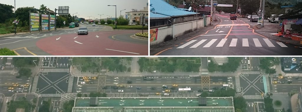
Well, one of the challenges in today’s mobility we have is the limited space. Now, we want to reserve a specific lane for these vehicles and the available space is going to be reduced for the conventional vehicles. To have overtaking possibilities (esp. for emergency vehicles) we need at least two lanes per direction per vehicles type, because of the lane separation. You will also need some kind of overtaking possibility in case of a breakdown. Especially in dense urban environments this could become complicated and currently bicycle riders rightly claim more space for the growing amount of two-wheelers as well. In these urban areas we still have to interact with all the remaining road users at one point: Intersections and crossings often cannot be avoided. And how to continue with the drive when the special-purpose lane ends? Switching back to manual driving? What happens with SAE Level 4 vehicles without a driver seat (and steering wheel) after leaving such a dedicated lane?
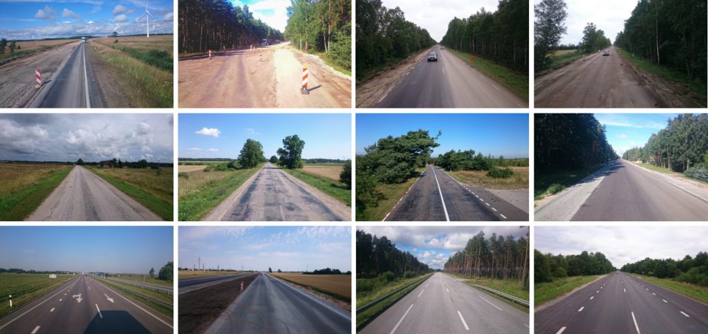
Nevertheless, there is one flagship project in Michigan organized by Cavnue: 40 Miles of the Interstate 94 and the Michigan Avenue between Detroit and Ann Arbor, MI, would be retrofitted to include a dedicated lane for self-driving vehicles. It is quite interesting to see that they start with the least complex road type you could come up with: Motorways. They already come with separation of driving directions, there are (in general) no level crossings or intersections. The majority of the traffic travels with similar speed and very easily to predict trajectory. Mobileye is already traveling with 130 km/h on German motorways in Level 4 for testing purpose.
But first Cavnue will let test automated driving on the conventional roads for two years and then set up a prototypic one-mile test lane on which testing will continue. The focus is on automated buses and is supposed to improve transit. They also claim that new jobs will be created, such as remote operators and staff to monitor the buses and to greet riders. Liftboy is a job of everybody’s dreams of all times. And “solving the infrastructural issues” mentioned in the previous paragraph is also part of the flagship project…
Process the Exiting Infrastructure
Is this a good investment? The question is already on the table. What about trying to assess the current infrastructure and make it more intelligible for automated driving? We all know that a high-definition map is one of the keys for automated driving. Let’s add a new layer to the existing data and tell if the roads are easy to handle.
One initiative with this idea in mind is the Connected and Autonomous Vehicles Road Scoring Index. In their comprehensive report they analyzed the current challenges of automated driving and broke them down into index parameters that can be derived from already existing databases or data collection methods. The determined index will be applied to map data. This makes it possible to access this information using standard geographic information systems (GIS).
The proposed index parameters are road marking quality, road sign visibility, communication coverage and positioning accuracy, weather, junction control, traffic participant access, surface reflectivity, road environment complexity and road traffic collision rates. All these parameters are graded from 1 to 3 from less suitable to more suitable to navigate for automated driving. With a weight on each parameter you can adapt the score to the capabilities of your system (e.g. no issues with positioning but more challenges with heterogeneous mix of traffic participants). At the end you could get a heat map with more and less complicated roads. For example, Cruise is also removing (temporary) some roads (some low speed roads as well as highways) from their initial service area in San Francisco, CA. You could assess the cumbersome roads and check, if a telic investment (e.g. renewing of lane marks) could improve the score without rebuilding the complete road.
Map-independent Processing Result Storage
Another more sophisticated approach is the Road2Automation (R2A) concept by German Aerospace Center. R2A focuses also on road complexity and quality as well as on supporting (or distracting) equipment such as road-side units (RSU), but additionally includes information about the course of the road (regarding slope and curvature). The sophistication is twofold:
- First, these scores are not modeled as additional attribute added to one element or edge in the road network database but modeled in 3d Simple Features. This allows to define the occurrence of specific elements as lines or areas. This can be used to define sections with special boundaries.
- The second feature is the possibility to use location referencing (e.g. by using OpenLR) for inter-map matching. That makes it possible to add this meta-data layer to any kind of map data without knowing exactly how and in which detail the target map data is modeled. It enables the updating of the scoring independently from the map data itself (even for proprietary maps from automated driving developers). Third parties (e.g. road operators or national road agencies) can provide this scoring and whoever is interested in this knowledge can consume it without having the need of using the map data, too.
The data for the scoring is, as already mentioned previously, available in different databases or can be derived from surveys of the roads that have to be conducted anyway.
Does this solve the problems for automated driving? No, it doesn’t. But it gives you a comprehensive view of the current road network and up-to-date changes if this data source is maintained by the road maintainers themselves (e.g. construction sites don’t have to be incorporated by all stakeholders individually). This meta-data layer can be used also by different stakeholders than automated driving, e.g. for route planning etc. It helps decision makers to see challenges for automated driving by comparing the capabilities and Operational Design Domain.
Conclusion
In our opinion, investing in a meta-data digital twin (and goal-driven investments to improve specific assets of the road infrastructure) is way more efficient than investing a huge amount of money for only a few miles of special-purpose roads for a small number of special-purpose vehicles. What do you think?
Recently a new journal article popped up that promotes also the idea of having exclusive lanes for automated driving: https://doi.org/10.1016/j.trc.2021.103440
Their thesis is that when autonomous vehicles will enter the market, they will significantly hinder the travel experience of all road users. The belief is that the cost of all traffic jams are higher than the cost of building dedicated lanes. Removing conventional lanes will add the traffic jams is objected because we already have special bus lanes o_O The authors propose to start with modifying motorways as well…
It is also their thesis that the traffic flow will improve to more coordinated driving by the automated vehicles. Yes, indeed, but if they are separated from the other traffic than no impact can happen. At the end not used automated driving lanes can be reused by conventional traffic if they are not needed in peak hours… back to the roots.